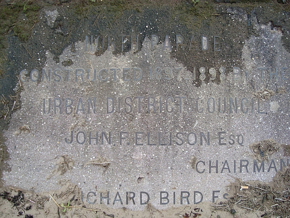
Well, well ! I thought this promenade wall plaque was buried under sand but as you can see it isn’t! I was out walking on the beach yesterday morning with our dog when I spotted this commemorative plaque in the prom wall. It’s actually easy to find as it’s just in the wall by the slipway of the old lifeboat station.
It confirms that the promenade wall was built between the years 1897 – 1898. Would that be the whole wall from Bennetts Lane in Meols to the Kings Gap I wonder? Considering the wall seems to constructed with sandstone block it’s lasting reasonably well. There has been some remedial work undertaken – recently concrete was pumped into holes drilled into the pavement.
How many years life has the wall got in it do you think?
I remember this from the late 70s, it was clearly visible all the time then.
John
Re Construction of sea walls
I had a look at the 1971 OS Map for Hoose. A wonderful hand drawn document, which I bought ( a copy ) from the Chester Records Office.. The only walls shown adjacent to the beach are at the end of Kings Gap and Beach Road. The 1899 OS map is more or less the same. However it was surveyed in 1897, perhaps before the work started as per the plaque. Of course they may have just not shown most of the wall. Many thanks for pointing out the plaque and the photo by Ian Davies.
I completely dug the plaque out to reveal its 9th and bottom line on 8/10/17.